


EERU - Ruhnu
Located in Kuressaare, Estonia
ICAO - EERU, IATA -
Data provided by AirmateGeneral information
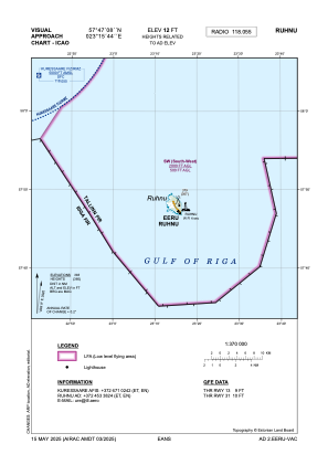
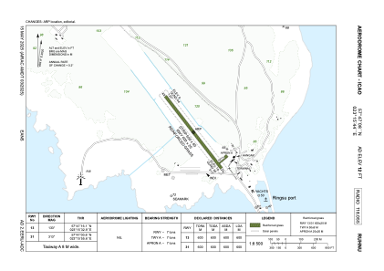
Coordinates: N57°47'2" E23°15'58"
Elevation is 10 feet MSL.
Magnetic variation is 9° East View others Airports in Saare County
Operational data
Special qualification required
Current time UTC:
Current local time:
Weather at : EEKE - Kuressaare ( 67 km )
METAR: EEKE 012350Z AUTO 08008KT 050V110 9999NDV NCD 10/03 Q1025
TAF: TAF EEKE 011400Z 0115/0121 08010KT CAVOK
Communications frequencies: [VIEW]
Runways:
| RWY identifier | QFU | Length (ft) | Width (ft) | Surface | LDA (ft) |
| 13 | 0° | 1969 | 66 | UNK | |
| 31 | 0° | 1969 | 66 | UNK |
Airport contact information
Address: Kuressaare Estonia