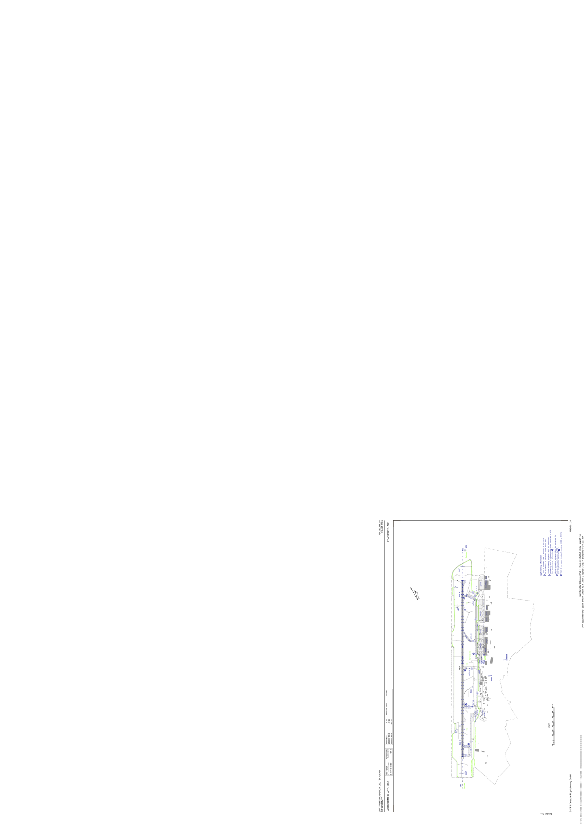


EDFH - Frankfurt-Hahn
Located in Kirchberg, Germany
ICAO - EDFH, IATA - HHN
Data provided by AirmateGeneral information
Coordinates: N49°56'45" E7°15'40"
Elevation is 1649 feet MSL.
Magnetic variation is 2.0500° East View others Airports in Rhineland-Palatinate
Operational data
Special qualification required
Current time UTC:
Current local time:
Weather
METAR: EDFH 040220Z 19004KT CAVOK 06/03 Q1015
TAF: TAF EDFH 032300Z 0400/0424 21006KT CAVOK BECMG 0402/0405 15010KT PROB40 TEMPO 0416/0424 SHRA BKN015TCU BECMG 0422/0424 BKN010
Communications frequencies: [VIEW]
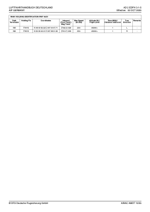
Runways:
| RWY identifier | QFU | Length (ft) | Width (ft) | Surface | LDA (ft) |
| 03 | 32° | 12467 | 148 | ASPH | 11483 |
| 21 | 212° | 12467 | 148 | ASPH | 11483 |
Airport contact information
Address: Kirchberg Germany