


DTTF - Gafsa/Ksar
Located in Gafsa, Tunisia
ICAO - DTTF, IATA - GAF
Data provided by AirmateGeneral information
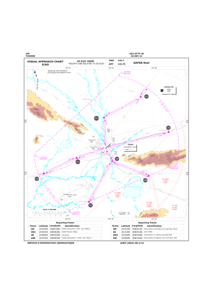
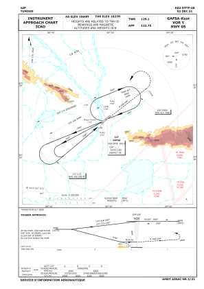
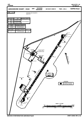
Coordinates: N34°24'56" E8°48'49"
Elevation is 1060 feet MSL.
Magnetic variation is 3° East View others Airports in Gafsa Governorate
Operational data
Special qualification required
Current time UTC:
Current local time:
Weather
METAR: DTTF 300000Z 04012KT CAVOK 19/14 Q1013
TAF: TAF DTTF 300000Z 3001/3010 04012KT 9999 FEW030
Communications frequencies: [VIEW]
Runways:
| RWY identifier | QFU | Length (ft) | Width (ft) | Surface | LDA (ft) |
| 05 | 49° | 9514 | 148 | ASP | |
| 23 | 229° | 9514 | 148 | ASP |
Airport contact information
Address: Gafsa Tunisia