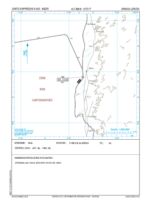


DRZD - Dirkou
Located in , Niger
ICAO - DRZD, IATA -
Data provided by AirmateGeneral information
Coordinates: N18°58'8" E12°52'8"
Elevation is 1273 feet MSL.
View others Airports in Agadez Region
Operational data
Special qualification required
Current time UTC:
Current local time:
Weather at : - ( 0 km )
METAR: KXSA 291335Z AUTO 20005KT 10SM CLR 22/16 A3006 RMK AO2 T02220164
Communications frequencies: [VIEW]
Runways:
| RWY identifier | QFU | Length (ft) | Width (ft) | Surface | LDA (ft) |
| 04 | 41° | 5249 | 131 | ASP | |
| 22 | 221° | 5249 | 131 | ASP |
Airport contact information
Address: Niger