


DABT - Batna / Mostapha Ben Boulaid
Located in Batna, Algeria
ICAO - DABT, IATA - BLJ
Data provided by AirmateGeneral information
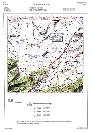
Coordinates: N35°45'33" E6°19'21"
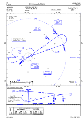
Elevation is 2700 feet MSL.
View others Airports in Batna Province
Operational data
Special qualification required
Current time UTC:
Current local time:
Weather
METAR: DABT 290700Z 00000KT 8000 NSC 15/08 Q1013
TAF: TAF DABT 290500Z 2906/3006 23008KT 9999 FEW026 BECMG 2910/2912 18012KT TEMPO 2912/2918 FEW026CB BKN030 BECMG 2917/2919 02008KT TEMPO 2922/3006 FEW023CB BKN026
Communications frequencies: [VIEW]
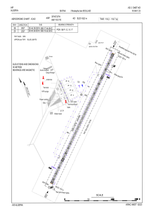
Runways:
| RWY identifier | QFU | Length (ft) | Width (ft) | Surface | LDA (ft) |
| 05 | 55° | 9843 | 148 | ASP | |
| 23 | 235° | 9843 | 148 | ASP |
Airport contact information
Address: Batna Algeria
