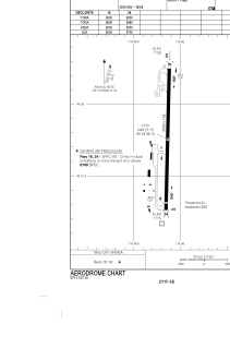


CYYF - Penticton
Located in Penticton, Canada
ICAO - CYYF, IATA - YYF
Data provided by AirmateGeneral information
Coordinates: N49°27'47" W119°36'8"
Elevation is 1130 feet MSL.
Magnetic variation is 18° East View others Airports in British Columbia
Operational data
Special qualification required
Current time UTC:
Current local time:
Weather
METAR: CYYF 290000Z 02004KT 310V070 15SM BKN062 OVC100 13/02 A2982 RMK SC6AC2 SLP107
TAF: TAF CYYF 290040Z 2901/2913 19008KT P6SM FEW060 BKN120 TEMPO 2901/2907 P6SM -SHRA BKN060 FM290700 35007KT P6SM SCT090 RMK NXT FCST BY 290700Z
Communications frequencies: [VIEW]
Runways:
| RWY identifier | QFU | Length (ft) | Width (ft) | Surface | LDA (ft) |
| 16 | 181° | 6000 | 148 | ASPH | 6000 |
| 34 | 1° | 6000 | 148 | ASPH | 5700 |
Airport contact information
Address: Penticton Canada
