


CYTS - Timmins
Located in Timmins, Canada
ICAO - CYTS, IATA - YTS
Data provided by AirmateGeneral information
Coordinates: N48°34'11" W81°22'36"
Elevation is 968 feet MSL.
Magnetic variation is -11° East View others Airports in Ontario
Operational data
Special qualification required
Current time UTC:
Current local time:
Weather
METAR: CYTS 281520Z 33009KT 2 1/2SM -SN BR OVC008 00/M01 A3016 RMK SC8 SLP228
TAF: TAF AMD CYTS 281409Z 2814/2902 33010G20KT 5SM -SNRA OVC009 TEMPO 2814/2818 P6SM NSW SCT009 OVC012 PROB30 2814/2818 2SM -SNRA BR FM281800 35010KT P6SM OVC020 TEMPO 2818/2821 OVC030 FM282100 02009KT P6SM BKN030 BECMG 2823/2901 SCT030 RMK NXT FCST BY 282000Z
Communications frequencies: [VIEW]
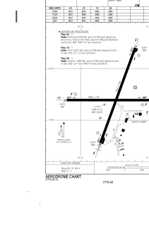
Runways:
| RWY identifier | QFU | Length (ft) | Width (ft) | Surface | LDA (ft) |
| 03 | 20° | 6000 | 150 | ASPH | 6000 |
| 21 | 200° | 6000 | 150 | ASPH | 6000 |
| 10 | 90° | 4903 | 150 | ASPH | 4907 |
| 28 | 270° | 4903 | 150 | ASPH | 4907 |
Airport contact information
Address: Timmins Canada