


CYEM - Manitoulin East Municipality
Located in Manitowaning, Canada
ICAO - CYEM, IATA - YEM
Data provided by AirmateGeneral information
Coordinates: N45°50'33" W81°51'27"
Elevation is 870 feet MSL.
Magnetic variation is -9° East View others Airports in Ontario
Operational data
Special qualification required
Current time UTC:
Current local time:
Weather at : CYZE - Gore Bay-Manitoulin ( 55 km )
METAR: CYZE 281700Z AUTO 03011KT 9SM OVC021 11/06 A3007 RMK SLP189
TAF: TAF AMD CYZE 281621Z 2816/2822 02010G20KT P6SM BKN020 TEMPO 2816/2820 BKN025 FM282000 04012KT P6SM BKN030 RMK FCST BASED ON AUTO OBS. NXT FCST BY 282000Z
Communications frequencies: [VIEW]
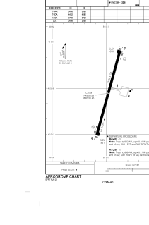
Runways:
| RWY identifier | QFU | Length (ft) | Width (ft) | Surface | LDA (ft) |
| 02 | 12° | 3498 | 100 | ASPH | 3498 |
| 20 | 192° | 3498 | 100 | ASPH | 3498 |
Airport contact information
Address: Manitowaning Canada