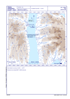


BGCO - Nerlerit Inaat
Located in Nerlerit Inaat, Greenland
ICAO - BGCO, IATA - CNP
Data provided by AirmateGeneral information
Coordinates: N70°44'35" W22°39'2"
Elevation is 45 feet MSL.
Magnetic variation is -18° East View others Airports in (unassigned)
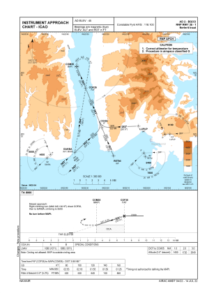
Operational data
Special qualification required
Current time UTC:
Current local time:
Weather
TAF: TAF BGCO 031200Z 0312/0316 VRB03KT 9999 FEW020 BKN100 TEMPO 0312/0316 BKN080
Communications frequencies: [VIEW]
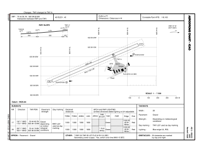
Runways:
| RWY identifier | QFU | Length (ft) | Width (ft) | Surface | LDA (ft) |
| 17 | 0° | 3281 | 98 | UNK | |
| 35 | 0° | 3281 | 98 | UNK |
Airport contact information
Address: Nerlerit Inaat Greenland