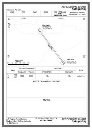


AYTA - Tari
Located in , Papua New Guinea
ICAO - AYTA, IATA - TIZ
Data provided by AirmateGeneral information
Coordinates: S5°50'41" E142°56'49"
Elevation is 5502 feet MSL.
View others Airports in Hela
Operational data
Special qualification required
Current time UTC:
Current local time:
Weather at : - ( 0 km )
METAR: ZMUB 251000Z VRB02MPS 9999 FEW030CB BKN033 04/M07 Q1007 NOSIG RMK QFE649.0 45 MOP
Communications frequencies: [VIEW]
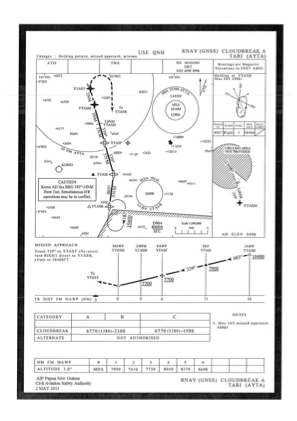
Runways:
| RWY identifier | QFU | Length (ft) | Width (ft) | Surface | LDA (ft) |
| 14 | 0° | 4856 | 98 | UNK | |
| 32 | 0° | 4856 | 98 | UNK |
Airport contact information
Address: Papua New Guinea