


ANYN - Nauru International Airport
Located in , Nauru
ICAO - ANYN, IATA - INU
Data provided by AirmateGeneral information
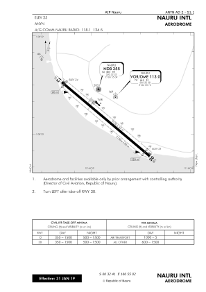
Coordinates: S0°32'41" E166°55'2"
Elevation is 22 feet MSL.
View others Airports in Yaren
Operational data
Special qualification required
Current time UTC:
Current local time:
Weather
METAR: ANYN 021200Z VRB02KT 9999 FEW020 27/26 Q1009
TAF: TAF ANYN 020200Z 0206/0306 09007KT 9999 SCT020 SCT150 T 31 28 26 27 Q 1008 1010 1009 1007
Communications frequencies: [VIEW]
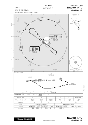
Runways:
| RWY identifier | QFU | Length (ft) | Width (ft) | Surface | LDA (ft) |
| 12 | 130° | 7054 | 148 | ASP | |
| 30 | 310° | 7054 | 148 | ASP |
Airport contact information
Address: Nauru