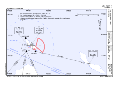
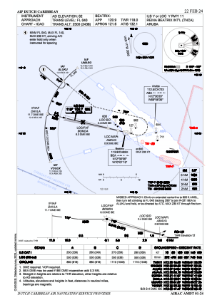
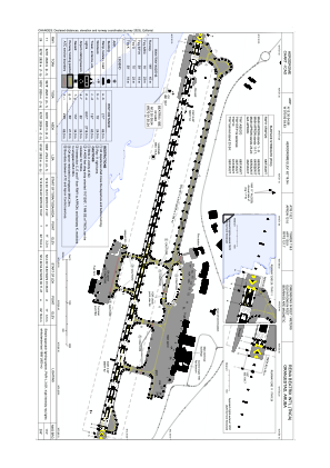


TNCA - International Reina Beatrix Airport
Located in Oranjestad, Aruba
ICAO - TNCA, IATA - AUA
Data provided by AirmateGeneral information
Coordinates: N12°30'5" W70°0'55"
Elevation is 62 feet MSL.
Magnetic variation is -11° East View others Airports in (unassigned)
Operational data
Special qualification required
Current time UTC:
Current local time:
Weather
METAR: TNCA 180200Z 08012KT 9999 BKN015 29/25 Q1011 NOSIG
TAF: TAF TNCA 180000Z 1800/1824 08015KT 9999 SCT016 PROB30 TEMPO 1804/1816 BKN014
Communications frequencies: [VIEW]
Runways:
| RWY identifier | QFU | Length (ft) | Width (ft) | Surface | LDA (ft) |
| 11 | 104° | 9277 | 148 | ASP | |
| 29 | 284° | 9277 | 148 | ASP |
Airport contact information
Address: Oranjestad Aruba