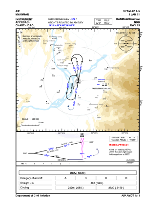
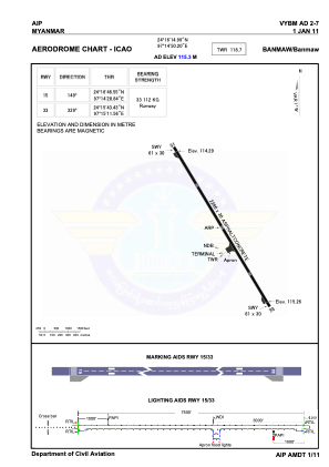


VYBM - Banmaw
Located in , Myanmar
ICAO - VYBM, IATA - BMO
Data provided by AirmateGeneral information
Coordinates: N24°16'15" E97°14'50"
Elevation is 378 feet MSL.
View others Airports in Kachin State
Operational data
Special qualification required
Current time UTC:
Current local time:
Weather at : - ( 0 km )
METAR: CYZE 272337Z AUTO 30012G17KT 9SM -RA SCT060 OVC075 16/14 A2952 RMK SLP000 DENSITY ALT 1400FT
Communications frequencies: [VIEW]
Runways:
| RWY identifier | QFU | Length (ft) | Width (ft) | Surface | LDA (ft) |
| 15 | 149° | 7500 | 98 | BIT | |
| 33 | 329° | 7500 | 98 | BIT |
Airport contact information
Address: Myanmar