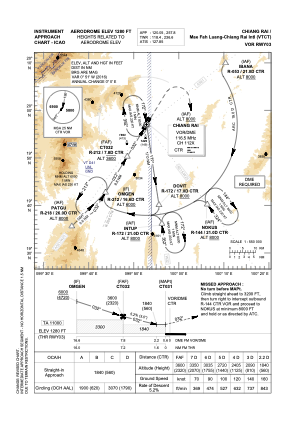
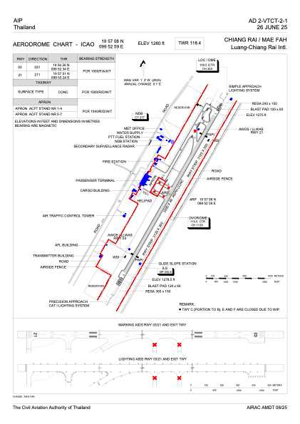


VTCT - Chiang Rai / Mae Fah Luang-Chiang Rai International Airport
Located in Chiang Rai, Thailand
ICAO - VTCT, IATA - CEI
Data provided by AirmateGeneral information
Coordinates: N19°57'8" E99°52'59"
Elevation is 1280 feet MSL.
View others Airports in Chiang Rai Province
Operational data
Special qualification required
Current time UTC:
Current local time:
Weather
METAR: VTCT 291200Z 25007KT 9999 FEW040 31/21 Q1004 NOSIG
TAF: TAF VTCT 291100Z 2912/3018 25005KT 9999 FEW040 BECMG 2921/2923 36005KT BECMG 3001/3003 16005KT BECMG 3004/3006 10005KT BECMG 3007/3009 24005KT
Communications frequencies: [VIEW]
Runways:
| RWY identifier | QFU | Length (ft) | Width (ft) | Surface | LDA (ft) |
| 03 | 30° | 9843 | 148 | ASP | |
| 21 | 210° | 9843 | 148 | ASP |
Airport contact information
Address: Chiang Rai Thailand