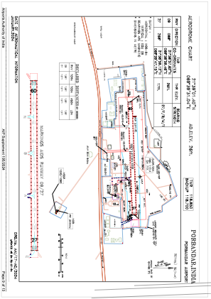


VAPR - Porbandar Airport, Porbandar
Located in Porbandar, India
ICAO - VAPR, IATA - PBD
Data provided by AirmateGeneral information
Coordinates: N21°39'1" E69°39'31"
Elevation is 23 feet MSL.
View others Airports in Gujarat
Operational data
Special qualification required
Current time UTC:
Current local time:
Weather
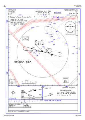
TAF: TAF VAPR 220200Z 2203/2212 30007KT 6000 FEW020 BECMG 2204/2206 28012KT NSC TEMPO 2208/2212 28015G25KT
Communications frequencies: [VIEW]
Runways:
| RWY identifier | QFU | Length (ft) | Width (ft) | Surface | LDA (ft) |
| 09 | 88° | 4498 | 148 | ASP | |
| 27 | 268° | 4498 | 148 | ASP |
Airport contact information
Address: Porbandar India