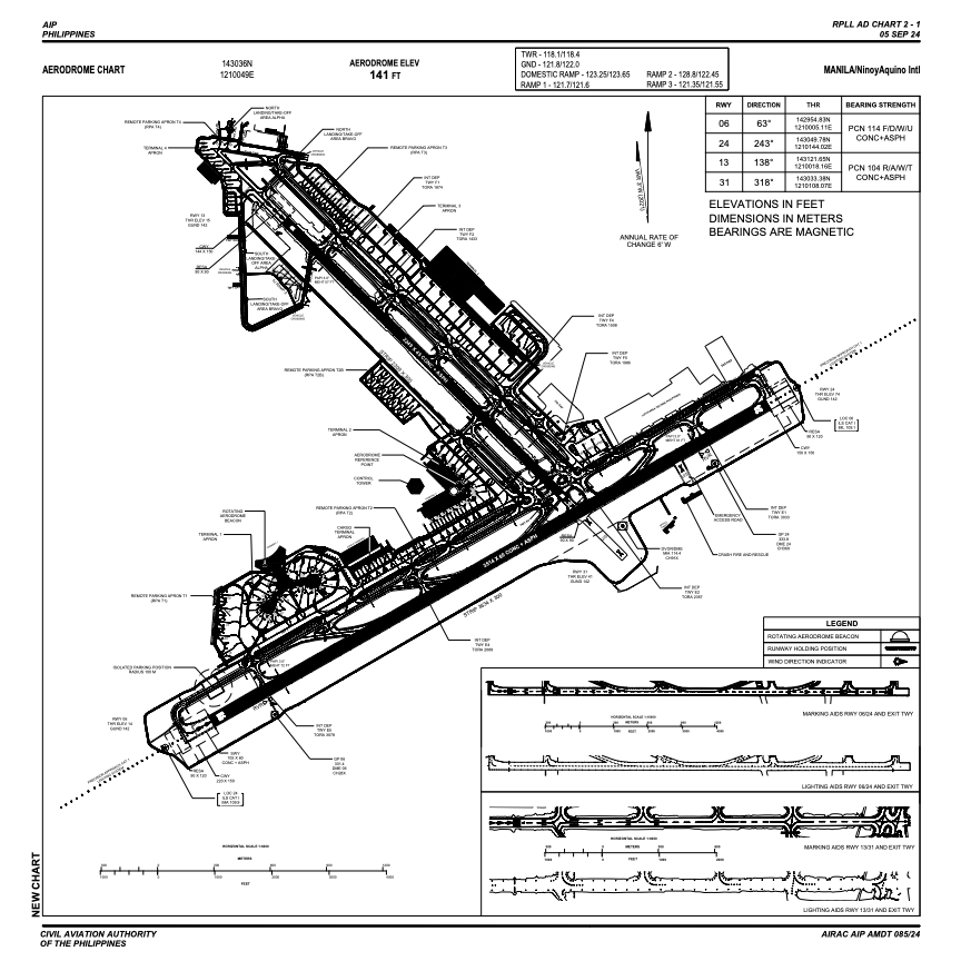


RPLL - Ninoy Aquino International Airport
Located in Manila, Philippines
ICAO - RPLL, IATA - MNL
Data provided by AirmateGeneral information
Coordinates: N14°30'36" E121°0'49"
Elevation is 75 feet MSL.
Magnetic variation is -3° East Operational data
Special qualification required
Current time UTC:
Current local time:
Communications frequencies: [VIEW]
Runways:
| RWY identifier | QFU | Length (ft) | Width (ft) | Surface | LDA (ft) |
| 06 | 60° | 11529 | 197 | CONC+ASPH | 11184 |
| 24 | 240° | 11529 | 197 | CONC+ASPH | 11184 |
| 13 | 135° | 7379 | 148 | CONC+ASPH | 6906 |
| 31 | 315° | 7379 | 148 | CONC+ASPH |
Airport contact information
Address: Manila Philippines