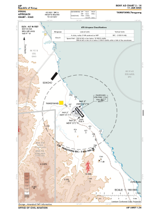

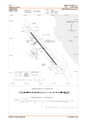


RKNY - Yangyang / International
Located in Yangyang, Korea, Republic of
ICAO - RKNY, IATA - YNY
Data provided by AirmateGeneral information
Coordinates: N38°3'41" E128°40'9"
Elevation is 241 feet MSL.
Magnetic variation is -9° East View others Airports in Gang'weondo
Operational data
Special qualification required
Current time UTC:
Current local time:
Weather
TAF: TAF RKNY 091700Z 0918/1024 27020G45KT CAVOK TN16/0921Z TX26/1005Z TN17/1021Z BECMG 0922/0924 27017G35KT BECMG 1002/1004 26015G25KT BECMG 1006/1008 26010KT BECMG 1010/1012 20008KT
Communications frequencies: [VIEW]
Runways:
| RWY identifier | QFU | Length (ft) | Width (ft) | Surface | LDA (ft) |
| 15 | 141° | 8202 | 148 | CON | |
| 33 | 321° | 8202 | 148 | CON |
Airport contact information
Address: Yangyang Korea, Republic of