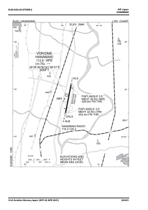
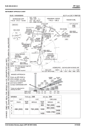
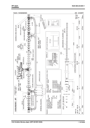


RJSI - Hanamaki
Located in Hanamaki, Japan
ICAO - RJSI, IATA - HNA
Data provided by AirmateGeneral information
Coordinates: N39°25'43" E141°8'7"
Elevation is 294 feet MSL.
View others Airports in Iwate Prefecture
Operational data
Special qualification required
Current time UTC:
Current local time:
Weather
METAR: RJSI 210900Z 29013KT 260V330 9999 FEW040 SCT/// 15/08 Q1017
TAF: TAF RJSI 210505Z 2106/2212 29012KT 9999 FEW030 BECMG 2112/2114 02004KT BECMG 2200/2203 18014KT
Communications frequencies: [VIEW]
Runways:
| RWY identifier | QFU | Length (ft) | Width (ft) | Surface | LDA (ft) |
| 02 | 11° | 8202 | 148 | ASP | |
| 20 | 191° | 8202 | 148 | ASP |
Airport contact information
Address: Hanamaki Japan