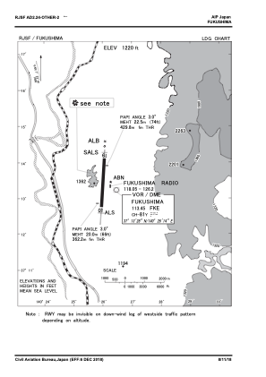
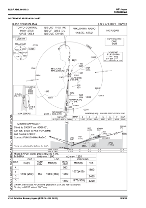
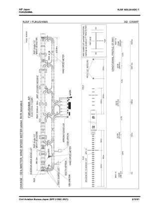


RJSF - Fukushima
Located in Koriyama, Japan
ICAO - RJSF, IATA - FKS
Data provided by AirmateGeneral information
Coordinates: N37°13'39" E140°25'41"
Elevation is 1220 feet MSL.
View others Airports in Fukusima Prefecture
Operational data
Special qualification required
Current time UTC:
Current local time:
Weather
METAR: RJSF 160615Z 18011KT 160V220 9999 FEW004 BKN008 BKN012 19/18 Q1002 RMK 1ST004 5ST008 7CU012 A2959
TAF: TAF RJSF 160517Z 1606/1712 18012KT 9999 FEW020 SCT030 TEMPO 1606/1609 4000 BR FEW005 BKN008 BECMG 1610/1612 35010KT TEMPO 1621/1706 30016G26KT
Communications frequencies: [VIEW]
Runways:
| RWY identifier | QFU | Length (ft) | Width (ft) | Surface | LDA (ft) |
| 01 | 2° | 8202 | 197 | ASP | |
| 19 | 182° | 8202 | 197 | ASP |
Airport contact information
Address: Koriyama Japan