


POKA - Tununak
Located in Tununak, United States
ICAO - 4KA, IATA -
Data provided by AirmateGeneral information
Coordinates: N60°34'10" W165°14'47"
Elevation is 62 feet MSL.
Magnetic variation is 16° East View others Airports in Alaska
Operational data
Special qualification required
Current time UTC:
Current local time:
Weather at : PAOO - Toksook Bay ( 9 km )
METAR: PAOO 040056Z AUTO 04014KT 10SM -RA BKN017 BKN037 OVC045 04/03 A2932 RMK AO2 SLP933 P0000 T00390028 TSNO $
Communications frequencies: [VIEW]
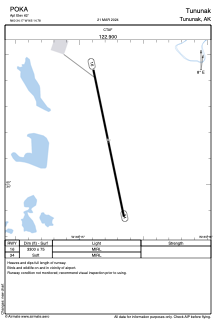
Runways:
| RWY identifier | QFU | Length (ft) | Width (ft) | Surface | LDA (ft) |
| 16 | 168° | 3300 | 75 | GRAVE | |
| 34 | 348° | 3300 | 75 | GRAVE |
Airport contact information
Address: Tununak United States