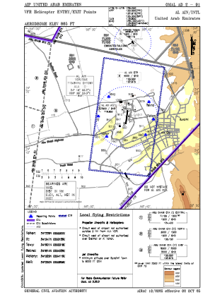
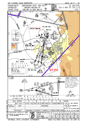
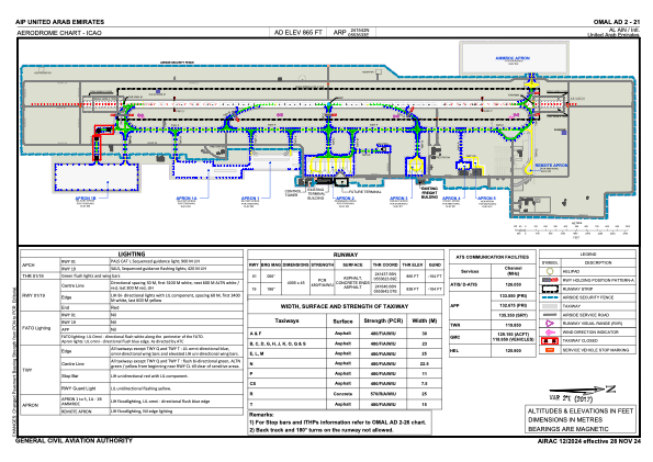


OMAL - Al Ain / International
Located in Al Ain, United Arab Emirates
ICAO - OMAL, IATA - AAN
Data provided by AirmateGeneral information
Coordinates: N24°15'42" E55°36'33"
Elevation is 866 feet MSL.
View others Airports in Abu Dhabi Emirate
Operational data
Special qualification required
Current time UTC:
Current local time:
Weather
TAF: TAF OMAL 270500Z 2706/2812 16009KT 8000 NSC BECMG 2708/2710 34015KT PROB30 TEMPO 2710/2714 34015G25KT 4000 BLDU BECMG 2718/2720 05006KT BECMG 2723/2801 18010KT BECMG 2807/2809 24008KT BECMG 2810/2812 30014KT
Communications frequencies: [VIEW]
Runways:
| RWY identifier | QFU | Length (ft) | Width (ft) | Surface | LDA (ft) |
| 01 | 7° | 13140 | 148 | ASP | |
| 19 | 187° | 13140 | 148 | ASP |
Airport contact information
Address: Al Ain United Arab Emirates