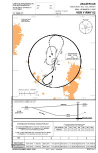
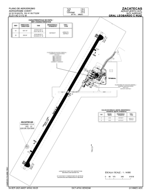


MMZC - Zacatecas Aeropuerto Internacional Gral. Leobardo C. Ruiz
Located in Zacatecas, Mexico
ICAO - MMZC, IATA - ZCL
Data provided by AirmateGeneral information
Coordinates: N22°53'51" W102°41'9"
Elevation is 7126 feet MSL.
View others Airports in Zacatecas
Operational data
Special qualification required
Current time UTC:
Current local time:
Communications frequencies: [VIEW]
Runways:
| RWY identifier | QFU | Length (ft) | Width (ft) | Surface | LDA (ft) |
| 02 | 28° | 9843 | 148 | ASP | |
| 20 | 208° | 9843 | 148 | ASP |
Airport contact information
Address: Zacatecas Mexico