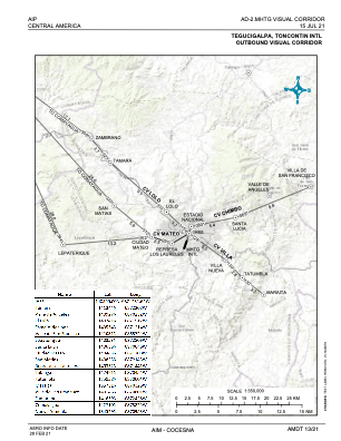
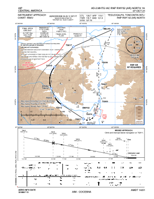
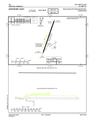


MHTG - Toncontin
Located in Tegucigalpa, Honduras
ICAO - MHTG, IATA - TGU
Data provided by AirmateGeneral information
Coordinates: N14°3'37" W87°13'3"
Elevation is 3307 feet MSL.
View others Airports in Francisco Morazan
Operational data
Special qualification required
Current time UTC:
Current local time:
Weather
TAF: TAF MHTG 240430Z 2406/2506 VRB03KT 9999 SCT036 TX31/2420Z TN19/2412Z BECMG 2410/2412 5000 FU FEW010 BKN028 BECMG 2415/2417 06012KT 9999 NSW SCT030TCU TEMPO 2422/2504 4000 SHRA SCT035TCU FEW038CB BECMG 2504/2506 VRB04KT 9999 NSW BKN032
Communications frequencies: [VIEW]
Runways:
| RWY identifier | QFU | Length (ft) | Width (ft) | Surface | LDA (ft) |
| 02 | 19° | 6631 | 148 | ASP | |
| 20 | 199° | 6631 | 148 | ASP |
Airport contact information
Address: Tegucigalpa Honduras