


LZTT - Poprad-Tatry
Located in Poprad, Slovakia
ICAO - LZTT, IATA - TAT
Data provided by AirmateGeneral information
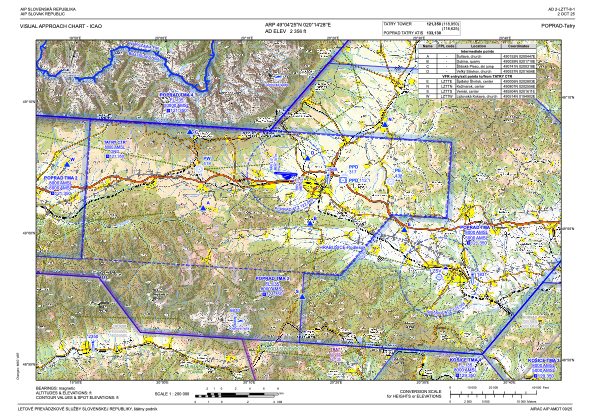
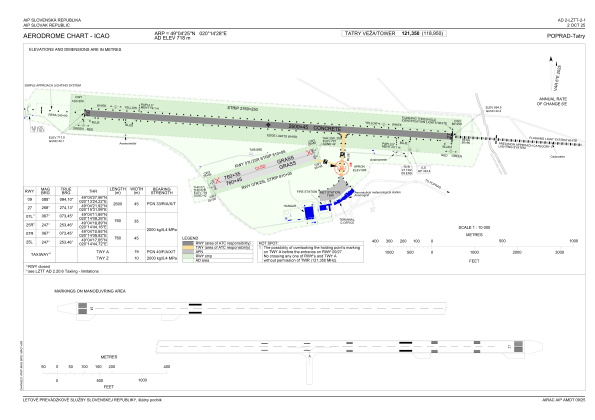
Coordinates: N49°4'25" E20°14'28"
Elevation is 2355 feet MSL.
Magnetic variation is 5.6119° East View others Airports in Košice
Operational data
Special qualification required
Current time UTC:
Current local time:
Weather
METAR: LZTT 151400Z 15007KT 110V200 9999 SCT066 19/02 Q1016 NOSIG
TAF: TAF LZTT 151115Z 1512/1612 13006KT 9999 FEW060 TEMPO 1512/1517 SHRA FEW030CB BKN040 BECMG 1518/1520 VRB02KT BECMG 1607/1609 10008KT
Communications frequencies: [VIEW]
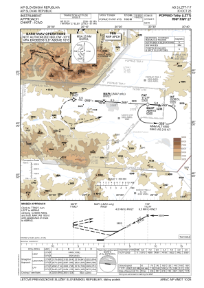
Runways:
| RWY identifier | QFU | Length (ft) | Width (ft) | Surface | LDA (ft) |
| 09 | 94° | 8530 | 148 | CONC | 8530 |
| 27 | 274° | 8530 | 148 | CONC | 8530 |
| 07R | 73° | 2493 | 148 | GRASS | 2493 |
| 25L | 253° | 2493 | 148 | GRASS | 2493 |
| 07L | 73° | 2493 | 115 | GRASS | 2493 |
| 25R | 253° | 2493 | 115 | GRASS | 2493 |
Airport contact information
Address: Poprad Slovakia

