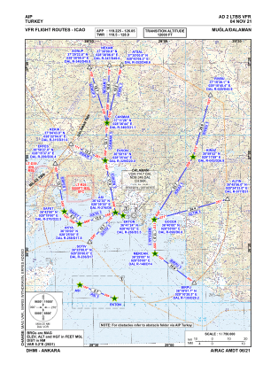
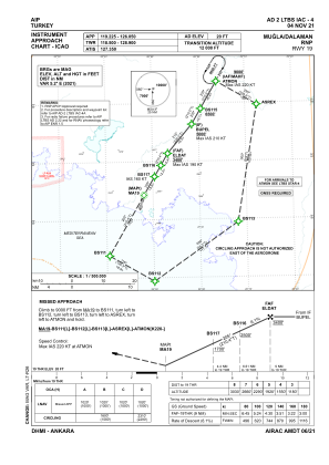
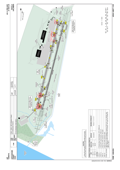


LTBS - Mugla Dalaman
Located in Dalaman, Turkey
ICAO - LTBS, IATA - DLM
Data provided by AirmateGeneral information
Coordinates: N36°42'45" E28°47'29"
Elevation is 20 feet MSL.
Magnetic variation is 4.8° East View others Airports in Mugla
Operational data
Special qualification required
Current time UTC:
Current local time:
Weather
METAR: LTBS 240950Z 33017KT 300V360 9999 FEW030 29/08 Q1009 NOSIG RMK RWY19 32018KT 290V350 1CU030
TAF: TAF LTBS 240440Z 2406/2506 33008KT CAVOK BECMG 2406/2408 33018KT
Communications frequencies: [VIEW]
Runways:
| RWY identifier | QFU | Length (ft) | Width (ft) | Surface | LDA (ft) |
| 01 | 15° | 9843 | 148 | CONC | 9843 |
| 19 | 195° | 9843 | 148 | CONC | 9843 |
Airport contact information
Address: Dalaman Turkey
