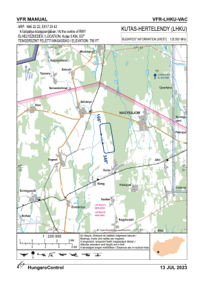
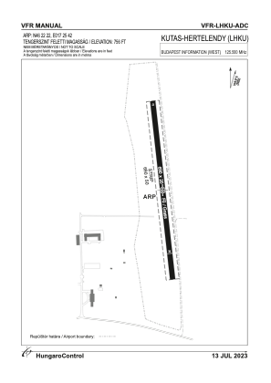


LHKU - Kutas-Hertelendy
Located in Kutas, Hungary
ICAO - , IATA -
Data provided by AirmateGeneral information
Coordinates: N46°22'22" E17°25'42"
Elevation is 470 feet MSL.
View others Airports in (unassigned)
Operational data
Special qualification required
Current time UTC:
Current local time:
Weather at : LHSM - Heviz-Balaton Airport ( 40 km )
METAR: LHSM 111545Z AUTO 30003KT 250V350 CAVOK 22/08 Q1018
TAF: TAF LHSM 111115Z 1112/1121 VRB03KT CAVOK
Communications frequencies: [VIEW]
Runways:
| RWY identifier | QFU | Length (ft) | Width (ft) | Surface | LDA (ft) |
| 17 | 0° | 2264 | 66 | GRASS | |
| 35 | 0° | 2264 | 66 | GRASS |
Airport contact information
Address: Kutas Hungary