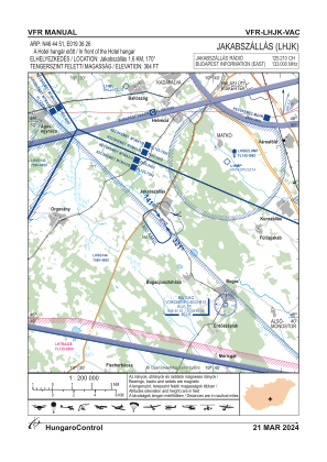
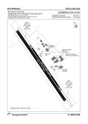


LHJK - Jakabszallas
Located in Jakabszallas, Hungary
ICAO - LHJK, IATA -
Data provided by AirmateGeneral information
Coordinates: N46°44'51" E19°36'26"
Elevation is 364 feet MSL.
View others Airports in Bács-Kiskun
Operational data
Special qualification required
Current time UTC:
Current local time:
Communications frequencies: [VIEW]
Runways:
| RWY identifier | QFU | Length (ft) | Width (ft) | Surface | LDA (ft) |
| 14L | 0° | 1969 | 59 | ASPH | |
| 32R | 0° | 1969 | 59 | ASPH | |
| 14R | 0° | 3068 | 98 | GRASS | |
| 32L | 0° | 3068 | 98 | GRASS |
Airport contact information
Address: Jakabszallas Hungary