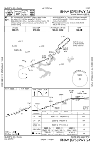


KSPZ - Silver Springs
Located in Silver Springs, United States
ICAO - SPZ, IATA -
Data provided by AirmateGeneral information
Coordinates: N39°24'11" W119°15'4"
Elevation is 4265 feet MSL.
Magnetic variation is 13° East View others Airports in Nevada
Operational data
Special qualification required
Current time UTC:
Current local time:
Weather at : KRNO - Reno/Tahoe Intl ( 46 km )
METAR: KRNO 040155Z 29014G20KT 10SM FEW080 SCT250 22/M01 A2983 RMK AO2 SLP067 T02171006
TAF: KRNO 032340Z 0400/0424 10007KT P6SM FEW080 SCT250 FM040600 18006KT P6SM BKN250 WS020/23040KT FM041200 19018G27KT P6SM FEW090 BKN200 WS020/21045KT FM041500 19032G37KT P6SM SCT050 BKN200 FM042100 21020G30KT P6SM -RA BKN050
Communications frequencies: [VIEW]
Runways:
| RWY identifier | QFU | Length (ft) | Width (ft) | Surface | LDA (ft) |
| 06 | 0° | 6001 | 75 | ASPH | |
| 24 | 0° | 6001 | 75 | ASPH |
Airport contact information
Address: Silver Springs United States