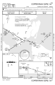


KNHU - Norfolk Ns
Located in Norfolk, United States
ICAO - NHU, IATA -
Data provided by AirmateGeneral information
Coordinates: N36°57'20" W76°18'14"
Elevation is 10 feet MSL.
Magnetic variation is -10° East View others Airports in Virginia
Operational data
Special qualification required
Current time UTC:
Current local time:
Weather at : KNGU - Norfolk Ns (Chambers Fld) ( 2 km )
METAR: KNGU 210259Z 00000KT 9SM BKN007 14/13 A3006 RMK AO2 SLP178 T01440128 51010
TAF: TAF KNGU 2023/2123 08008KT 9999 FEW010 FEW250 QNH3000INS TEMPO 2023/2102 SCT010 BKN050 BECMG 2102/2104 VRB06KT 9999 BKN010 OVC050 QNH2998INS TEMPO 2104/2110 2400 BR OVC004 BECMG 2116/2118 09008KT 9999 FEW025 QNH2996INS TX20/2119Z TN13/2109Z FN20079
Communications frequencies: [VIEW]
Runways:
| RWY identifier | QFU | Length (ft) | Width (ft) | Surface | LDA (ft) |
| 09 | 86° | 1705 | 150 | ASPH | |
| 27 | 266° | 1705 | 150 | ASPH | |
| H1 | 0° | 0 | 0 | UNK | |
| H2 | 0° | 0 | 0 | UNK | |
| H3 | 0° | 0 | 0 | UNK | |
| H4 | 0° | 0 | 0 | UNK | |
| H5 | 0° | 0 | 0 | UNK | |
| H6 | 0° | 0 | 0 | UNK | |
| H7 | 0° | 0 | 0 | UNK | |
| H8 | 0° | 0 | 0 | UNK | |
| H9 | 0° | 0 | 0 | UNK |
Airport contact information
Address: Norfolk United States