


KMIB - Minot Afb
Located in Minot, United States
ICAO - MIB, IATA -
Data provided by AirmateGeneral information
Coordinates: N48°24'57" W101°21'29"
Elevation is 1666 feet MSL.
Magnetic variation is 07° East View others Airports in North Dakota
Operational data
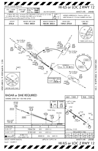
Special qualification required
Current time UTC:
Current local time:
Weather
METAR: KMIB 141955Z 09005KT 10SM CLR 21/09 A2972 RMK AO2A SLP068 T02110087
TAF: TAF AMD KMIB 141800Z 1418/1523 VRB06KT 9999 SCT050 QNH2971INS BECMG 1420/1421 33010G15KT 9000 -SHRA VCTS BKN030CB QNH2973INS TEMPO 1421/1501 33015G25KT 6000 -TSRA BECMG 1501/1502 33012G18KT 9999 NSW BKN015 QNH2975INS BECMG 1504/1505 33009KT 9999 OVC007 QNH2977INS BECMG 1505/1506 33009KT 6000 BR OVC005 QNH2981INS TEMPO 1508/1512 OVC002 BECMG 1514/1515 35009KT 9999 NSW BKN012 QNH2984INS BECMG 1517/1518 35009KT 9999 SCT025 QNH2983INS BECMG 1521/1522 35009KT 9999 FEW050 QNH2981INS TX21/1421Z TN07/1510Z
Communications frequencies: [VIEW]
Runways:
| RWY identifier | QFU | Length (ft) | Width (ft) | Surface | LDA (ft) |
| 12 | 125° | 13198 | 300 | OTHER | |
| 30 | 305° | 13198 | 300 | OTHER |
Airport contact information
Address: Minot United States