


KCBM - Columbus Afb
Located in Columbus, United States
ICAO - CBM, IATA - CBM
Data provided by AirmateGeneral information
Coordinates: N33°38'43" W88°26'45"
Elevation is 218 feet MSL.
Magnetic variation is 00° East View others Airports in Mississippi
Operational data
Special qualification required
Current time UTC:
Current local time:
Weather
METAR: KCBM 071055Z 19003KT 7SM BKN180 22/21 A2981 RMK AO2A SLP095 T02170207 $
TAF: TAF AMD KCBM 071130Z 0711/0815 19006KT 9999 SCT030 BKN180 QNH2979INS TEMPO 0712/0714 SCT005 BKN030 BECMG 0713/0714 21010G15KT 9999 VCSH SCT015 BKN030 OVC180 QNH2981INS BECMG 0715/0716 22012G20KT 8000 -SHRA VCTS BKN030CB OVC180 QNH2970INS TEMPO 0717/0720 27015G25KT 6000 -TSRA OVC030CB BECMG 0720/0721 21010KT 9999 VCTS BKN030CB QNH2968INS BECMG 0804/0805 21006KT 9999 NSW BKN010 OVC030 QNH2972INS BECMG 0812/0813 22012G20KT 9999 BKN010 OVC020 QNH2973INS TX30/0720Z TN22/0711Z
Communications frequencies: [VIEW]
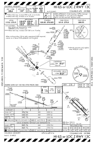
Runways:
| RWY identifier | QFU | Length (ft) | Width (ft) | Surface | LDA (ft) |
| 13C | 135° | 12004 | 300 | OTHER | |
| 31C | 315° | 12004 | 300 | OTHER | |
| 13L | 135° | 8001 | 150 | OTHER | |
| 31R | 315° | 8001 | 150 | OTHER | |
| 13R | 135° | 6320 | 175 | CONC | |
| 31L | 315° | 6320 | 175 | CONC |
Airport contact information
Address: Columbus United States