


KBWD - Brownwood Rgnl
Situé à Brownwood, United States
ICAO - BWD, IATA - BWD
Données fournies par AirmateInformation générale
Coordonnées: N31°47'37" W98°57'23"
Élévation : 1386 feet MSL.
Variation magnétique : 04° East Voir autres Aéroports à Texas
Données opérationnelles
Special qualification required
Heure actuelle UTC:
Heure actuelle locale:
Météo
METAR: KBWD 291155Z AUTO 06003KT 9SM OVC004 12/12 A2991 RMK AO1
Fréquences de communication: [VIEW]
Pistes:
| Identifiant RWY | QFU | Longueur (ft) | Largeur (ft) | Surface | LDA (ft) |
| 13 | 134° | 4608 | 101 | ASPH | |
| 31 | 314° | 4608 | 101 | ASPH | |
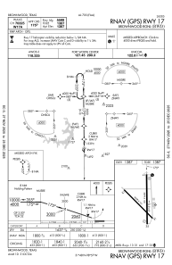
| 17 | 179° | 5599 | 100 | ASPH | |
| 35 | 359° | 5599 | 100 | ASPH |
Coordonnées de l'aéroport
Adresse: Brownwood United States
