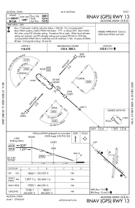


KAXA - Algona Muni
Located in Algona, United States
ICAO - AXA, IATA - AXG
Data provided by AirmateGeneral information
Coordinates: N43°4'41" W94°16'19"
Elevation is 1216 feet MSL.
Magnetic variation is 03° East View others Airports in Iowa
Operational data
Special qualification required
Current time UTC:
Current local time:
Weather
METAR: KAXA 191915Z AUTO 30022G32KT SCT050 08/M04 A3016 RMK A01
Communications frequencies: [VIEW]
Runways:
| RWY identifier | QFU | Length (ft) | Width (ft) | Surface | LDA (ft) |
| 12 | 132° | 3960 | 75 | CONC | |
| 30 | 312° | 3960 | 75 | CONC | |
| 18 | 189° | 2895 | 160 | GRASS | |
| 36 | 9° | 2895 | 160 | GRASS |
Airport contact information
Address: Algona United States
