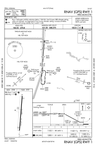


I76 - Peru Muni
Located in Peru, United States
ICAO - I76, IATA -
Data provided by AirmateGeneral information
Coordinates: N40°47'9" W86°8'47"
Elevation is 779 feet MSL.
Magnetic variation is -04° East View others Airports in Indiana
Operational data
Special qualification required
Current time UTC:
Current local time:
Weather at : KGUS - Grissom Arb ( 15 km )
TAF: TAF KGUS 211300Z 2113/2219 19009KT 9999 FEW050 SCT250 QNH2985INS BECMG 2115/2116 20015G25KT 9999 FEW050 SCT250 510005 QNH2974INS TEMPO 2116/2205 20020G30KT 510007 BECMG 2204/2205 18020G30KT 9999 SCT030 OVC050 510007 QNH2972INS BECMG 2207/2208 19020G30KT 9000 -SHRA VCTS FEW015CB BKN020 OVC040 QNH2974INS BECMG 2211/2212 21012G18KT 9999 NSW SCT030 QNH2978INS BECMG 2215/2216 23015G25KT 9999 SCT030 BKN060 510005 QNH2981INS TX32/2120Z TN20/2211Z
Communications frequencies: [VIEW]
Runways:
| RWY identifier | QFU | Length (ft) | Width (ft) | Surface | LDA (ft) |
| 01 | 5° | 4400 | 75 | ASPH | |
| 19 | 185° | 4400 | 75 | ASPH |
Airport contact information
Address: Peru United States