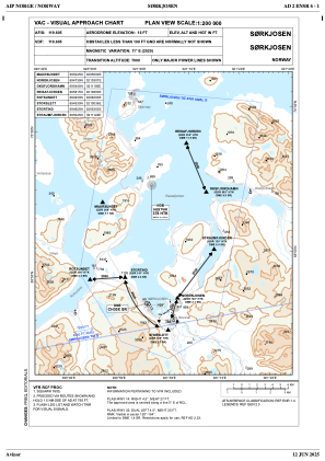
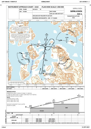
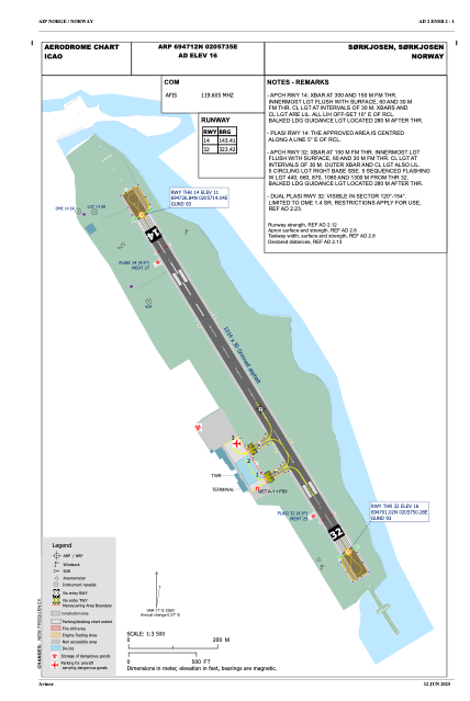


ENSR - Soerkjosen
Located in Soerkjosen, Norway
ICAO - ENSR, IATA - SOJ
Data provided by AirmateGeneral information
Coordinates: N69°47'12" E20°57'35"
Elevation is 16 feet MSL.
Magnetic variation is 10.7° East View others Airports in Troms
Operational data
Special qualification required
Current time UTC:
Current local time:
Weather
METAR: ENSR 141150Z 24005KT 180V320 CAVOK 17/05 Q1009 RMK WIND RWY 32 VRB02KT WIND 1119FT VRB02KT
TAF: TAF ENSR 141100Z 1412/1419 VRB05KT 9999 FEW040 BKN060
Communications frequencies: [VIEW]
Runways:
| RWY identifier | QFU | Length (ft) | Width (ft) | Surface | LDA (ft) |
| 14 | 0° | 3327 | 98 | UNK | |
| 32 | 0° | 3327 | 98 | UNK |
Airport contact information
Address: Soerkjosen Norway