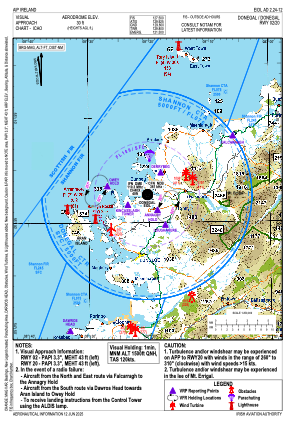
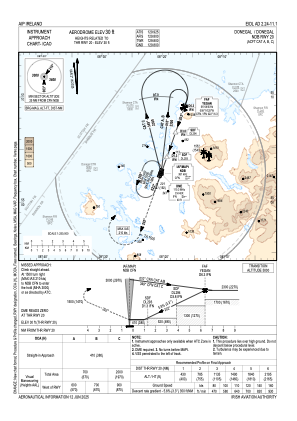
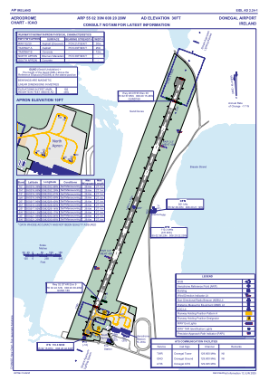


EIDL - Donegal
Located in Donegal Town, Ireland
ICAO - EIDL, IATA - CFN
Data provided by AirmateGeneral information
Coordinates: N55°2'39" W8°20'28"
Elevation is 31 feet MSL.
Magnetic variation is -2.85° East View others Airports in County Donegal
Operational data
Special qualification required
Current time UTC:
Current local time:
Weather
METAR: EIDL 211300Z 02005KT 2600 BR BKN003 OVC011 13/13 Q1011
TAF: TAF EIDL 211100Z 2112/2121 35009KT 0500 FG BKN001 BECMG 2112/2114 5000 BKN005 TEMPO 2112/2119 3000 -SHRA SCT030CB PROB30 TEMPO 2113/2116 2000 SHRA BR BKN003 BECMG 2114/2116 9999 NSW BKN012
Communications frequencies: [VIEW]
Runways:
| RWY identifier | QFU | Length (ft) | Width (ft) | Surface | LDA (ft) |
| 03 | 20° | 4908 | 98 | ASPH | 3799 |
| 21 | 200° | 4908 | 98 | ASPH | 3950 |
Airport contact information
Address: Donegal Town Ireland