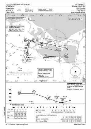
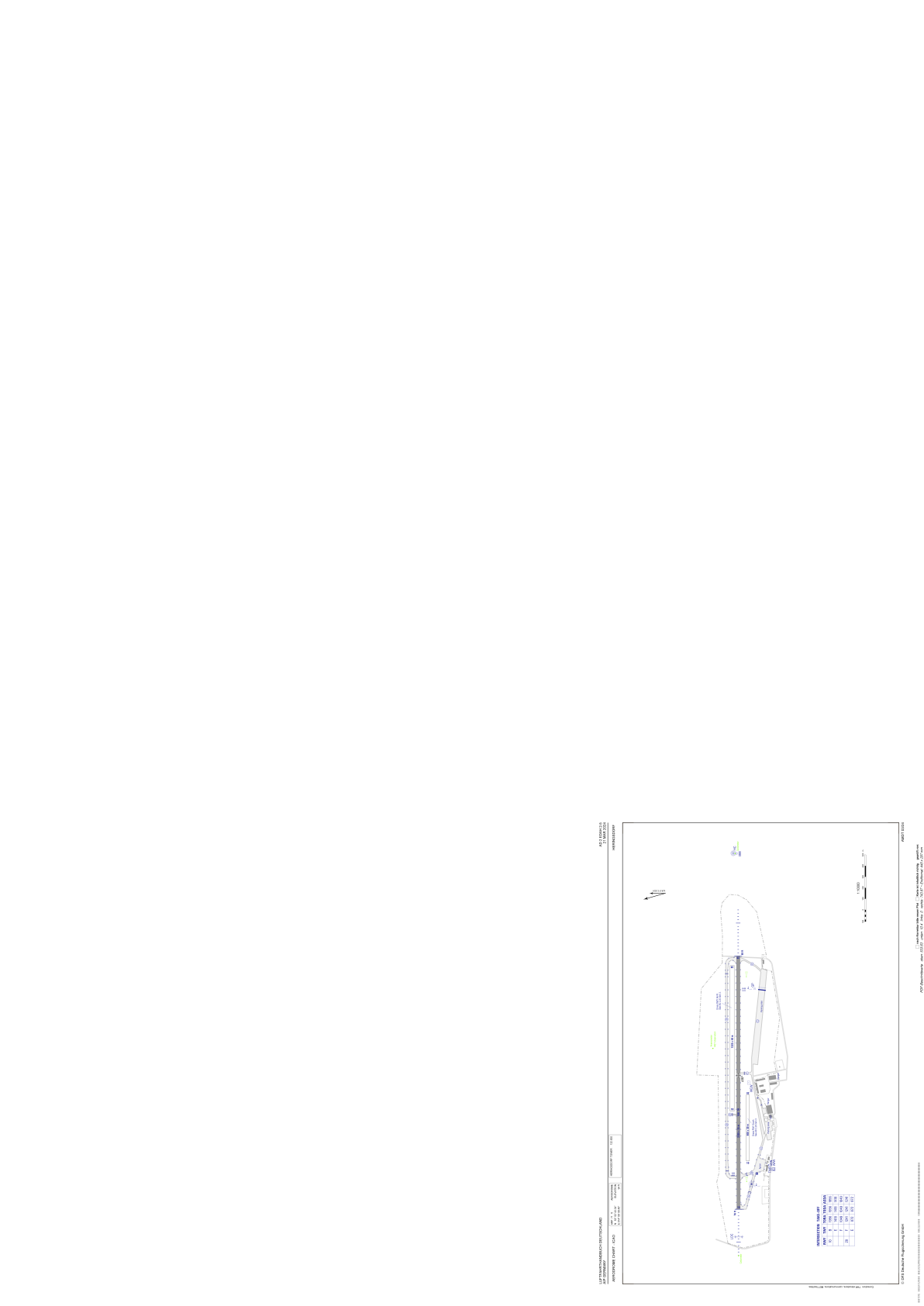


EDAH - Heringsdorf
Located in Heringsdorf, Germany
ICAO - EDAH, IATA - HDF
Data provided by AirmateGeneral information
Coordinates: N53°52'43" E14°9'8"
Elevation is 94 feet MSL.
Magnetic variation is 3.7000° East View others Airports in Mecklenburg-Vorpommern
Operational data
Special qualification required
Current time UTC:
Current local time:
Weather
METAR: EDAH 192250Z AUTO 03013KT 9999 // OVC010/// 05/04 Q1004
TAF: TAF EDAH 191700Z 1918/2003 13006KT 9999 SCT003 BKN011 TEMPO 1918/2001 04020G30KT 4000 -RA BECMG 1919/1921 06012KT PROB40 TEMPO 1919/1921 RA BECMG 1922/1924 04015G25KT
Communications frequencies: [VIEW]
Runways:
| RWY identifier | QFU | Length (ft) | Width (ft) | Surface | LDA (ft) |
| 10 | 106° | 7562 | 115 | ASPH | 7562 |
| 28 | 286° | 7562 | 115 | ASPH | 7562 |
Airport contact information
Address: Heringsdorf Germany
