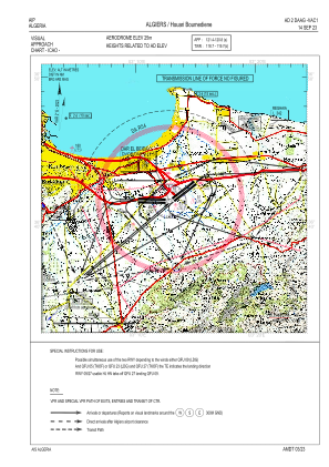
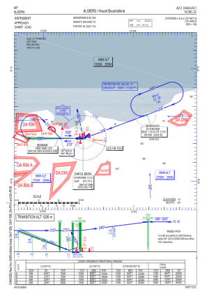
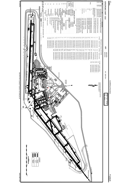


DAAG - Algiers / Houari Boumediene
Located in Algiers, Algeria
ICAO - DAAG, IATA - ALG
Data provided by AirmateGeneral information
Coordinates: N36°41'40" E3°13'1"
Elevation is 82 feet MSL.
Magnetic variation is 2° East View others Airports in Boumerdès Province
Operational data
Special qualification required
Current time UTC:
Current local time:
Weather
METAR: DAAG 160930Z 34009KT CAVOK 23/06 Q1011
TAF: TAF DAAG 160500Z 1606/1706 VRB02KT CAVOK BECMG 1608/1610 34012KT BECMG 1618/1620 VRB02KT
Communications frequencies: [VIEW]
Runways:
| RWY identifier | QFU | Length (ft) | Width (ft) | Surface | LDA (ft) |
| 05 | 53° | 11483 | 197 | ASP | |
| 23 | 233° | 11483 | 197 | ASP | |
| 09 | 92° | 11483 | 148 | ASP | |
| 27 | 272° | 11483 | 148 | ASP |
Airport contact information
Address: Algiers Algeria