


CYPW - Powell River
Located in Powell River, Canada
ICAO - CYPW, IATA - YPW
Data provided by AirmateGeneral information
Coordinates: N49°50'3" W124°30'1"
Elevation is 414 feet MSL.
Magnetic variation is 17.65° East View others Airports in British Columbia
Operational data
Special qualification required
Current time UTC:
Current local time:
Weather
METAR: CYPW 052100Z 13005KT 15SM -RA FEW009 SCT015 BKN045 OVC069 11/11 A2966 RMK ST1SC3SC2AC2 VIS N-E 3 LO CLD BR SLP048
Communications frequencies: [VIEW]
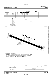
Runways:
| RWY identifier | QFU | Length (ft) | Width (ft) | Surface | LDA (ft) |
| 09 | 110° | 3621 | 150 | ASPH | 3621 |
| 27 | 290° | 3621 | 150 | ASPH | 3621 |
Airport contact information
Address: Powell River Canada