


63B - Limington-Harmon
Located in Limington, United States
ICAO - 63B, IATA -
Data provided by AirmateGeneral information
Coordinates: N43°45'47" W70°40'21"
Elevation is 292 feet MSL.
Magnetic variation is -17° East View others Airports in Maine
Operational data
Special qualification required
Current time UTC:
Current local time:
Weather at : KPWM - Portland Intl Jetport ( 32 km )
METAR: KPWM 211651Z 17007KT 10SM FEW140 BKN250 19/14 A2992 RMK AO2 SLP131 T01890144 $
TAF: KPWM 211722Z 2118/2218 17007KT P6SM FEW140 BKN250 FM220000 VRB04KT P6SM BKN150 FM220400 VRB03KT 2SM BR SCT100 FM221200 VRB04KT P6SM SCT250
Communications frequencies: [VIEW]
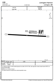
Runways:
| RWY identifier | QFU | Length (ft) | Width (ft) | Surface | LDA (ft) |
| 11 | 93° | 2973 | 50 | ASPH | |
| 29 | 273° | 2973 | 50 | ASPH |
Airport contact information
Address: Limington United States