


29N - Kroelinger
Located in Vineland, United States
ICAO - 29N, IATA -
Data provided by AirmateGeneral information
Coordinates: N39°31'26" W75°2'47"
Elevation is 93 feet MSL.
Magnetic variation is -10° East View others Airports in New Jersey
Operational data
Special qualification required
Current time UTC:
Current local time:
Weather at : KMIV - Millville Muni ( 17 km )
METAR: KMIV 220054Z AUTO 00000KT 10SM CLR 19/13 A2999 RMK AO2 SLP154 T01890128
TAF: KMIV 212333Z 2200/2224 18006KT P6SM SKC FM220100 18003KT P6SM FEW250 FM220800 VRB02KT P6SM FEW006 SCT250 FM221400 18006KT P6SM FEW250
Communications frequencies: [VIEW]
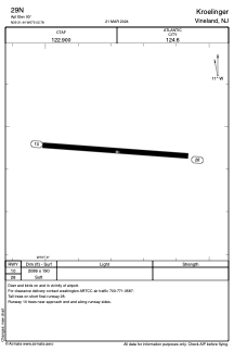
Runways:
| RWY identifier | QFU | Length (ft) | Width (ft) | Surface | LDA (ft) |
| 10 | 96° | 2086 | 190 | GRASS | |
| 28 | 276° | 2086 | 190 | GRASS |
Airport contact information
Address: Vineland United States