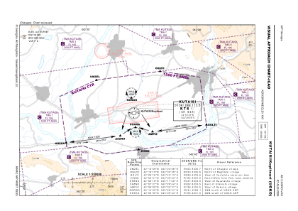
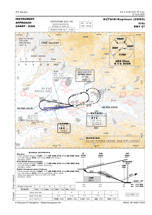
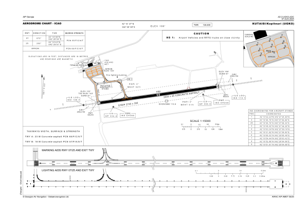


UGKO - Kutaisi/Kopitnari
Located in Kutaisi, Georgia
ICAO - UGKO, IATA - KUT
Data provided by AirmateGeneral information
Coordinates: N42°10'37" E42°28'58"
Elevation is 160 feet MSL.
Magnetic variation is 7° East View others Airports in Imereti
Operational data
Special qualification required
Current time UTC:
Current local time:
Weather
METAR: UGKO 160200Z 28007KT 9999 SCT016 BKN077 22/20 Q1009 NOSIG
TAF: TAF COR UGKO 152300Z 1600/1624 VRB02KT 9999 SCT030 BKN060 TX27/1610Z TN20/1602Z TEMPO 1600/1605 4500 TSRA SCT015 BKN023CB TEMPO 1610/1616 27010KT
Communications frequencies: [VIEW]
Runways:
| RWY identifier | QFU | Length (ft) | Width (ft) | Surface | LDA (ft) |
| 07 | 80° | 8202 | 148 | CONC+ASPH | 8202 |
| 25 | 260° | 8202 | 148 | CONC+ASPH | 8202 |
Airport contact information
Address: Kutaisi Georgia