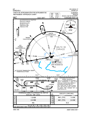
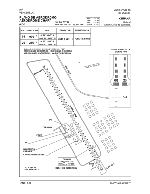


SVCU - Cumana / Mariscal Antonio Jose De Sucre Ntl
Located in Cumana, Venezuela
ICAO - SVCU, IATA - CUM
Data provided by AirmateGeneral information
Coordinates: N10°26'57" W64°7'56"
Elevation is 30 feet MSL.
Magnetic variation is -14° East View others Airports in Sucre
Operational data
Special qualification required
Current time UTC:
Current local time:
Communications frequencies: [VIEW]
Runways:
| RWY identifier | QFU | Length (ft) | Width (ft) | Surface | LDA (ft) |
| 08 | 62° | 10121 | 149 | ASPH | 10171 |
| 26 | 242° | 10121 | 149 | ASPH | 10171 |
Airport contact information
Address: Cumana Venezuela