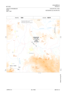


SPPY - Chachapoyas
Located in Chachapoyas, Peru
ICAO - SPPY, IATA - CHH
Data provided by AirmateGeneral information
Coordinates: S6°12'7" W77°51'22"
Elevation is 8333 feet MSL.
View others Airports in Amazonas Region
Operational data
Special qualification required
Current time UTC:
Current local time:
Weather
METAR: SPPY 171700Z 34006KT 9999 SCT015 SCT040 18/11 Q1028 RMK PP000
TAF: TAF SPPY 171100Z 1712/1812 05008KT 9999 SCT020 SCT050 TX20/1720Z TN09/1811Z TEMPO 1712/1714 3000 BCFG SCT008 BKN040
Communications frequencies: [VIEW]
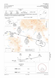
Runways:
| RWY identifier | QFU | Length (ft) | Width (ft) | Surface | LDA (ft) |
| 13 | 132° | 6496 | 98 | ASP | |
| 31 | 312° | 6496 | 98 | ASP |
Airport contact information
Address: Chachapoyas Peru