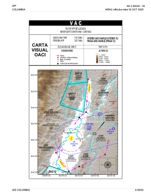
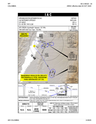


SKGO - Cartago-Santa Ana
Located in Cartago, Colombia
ICAO - SKGO, IATA - CRC
Data provided by AirmateGeneral information
Coordinates: N4°45'27" W75°57'22"
Elevation is 2981 feet MSL.
Magnetic variation is -7° East View others Airports in Valle del Cauca
Operational data
Special qualification required
Current time UTC:
Current local time:
Communications frequencies: [VIEW]
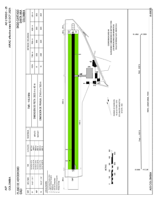
Runways:
| RWY identifier | QFU | Length (ft) | Width (ft) | Surface | LDA (ft) |
| 01 | 5° | 6644 | 131 | ASPH | 6644 |
| 19 | 185° | 6644 | 131 | ASPH | 6644 |
Airport contact information
Address: Cartago Colombia