


ROAH - Naha
Located in Naha, Japan
ICAO - ROAH, IATA - OKA
Data provided by AirmateGeneral information
Coordinates: N26°11'36" E127°38'23"
Elevation is 11 feet MSL.
View others Airports in Okinawa Prefecture
Operational data
Special qualification required
Current time UTC:
Current local time:
Communications frequencies: [VIEW]
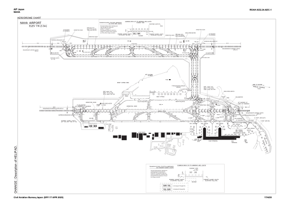
Runways:
| RWY identifier | QFU | Length (ft) | Width (ft) | Surface | LDA (ft) |
| 18L | 177° | 9843 | 148 | UNK | |
| 36R | 357° | 9843 | 148 | UNK | |
| 18R | 177° | 8858 | 197 | UNK | |
| 36L | 357° | 8858 | 197 | UNK |
Airport contact information
Address: Naha Japan