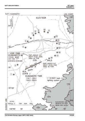
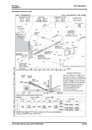
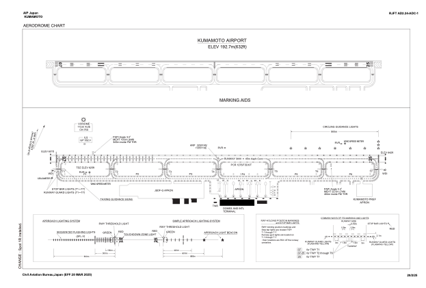


RJFT - Kumamoto
Located in Kumamoto, Japan
ICAO - RJFT, IATA - KMJ
Data provided by AirmateGeneral information
Coordinates: N32°50'14" E130°51'19"
Elevation is 632 feet MSL.
View others Airports in Kumamoto Prefecture
Operational data
Special qualification required
Current time UTC:
Current local time:
Communications frequencies: [VIEW]
Runways:
| RWY identifier | QFU | Length (ft) | Width (ft) | Surface | LDA (ft) |
| 07 | 65° | 9843 | 148 | ASP | |
| 25 | 245° | 9843 | 148 | ASP |
Airport contact information
Address: Kumamoto Japan