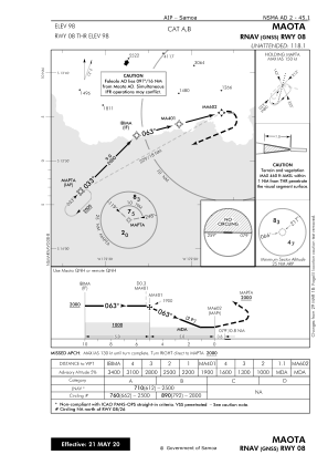
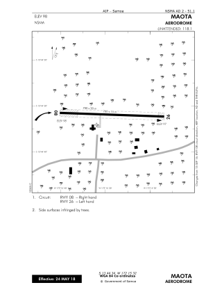


NSMA - Maota
Located in Salelologa, Samoa
ICAO - NSMA, IATA - MXS
Data provided by AirmateGeneral information
Coordinates: S13°44'34" W172°15'32"
Elevation is 98 feet MSL.
View others Airports in Palauli District
Operational data
Special qualification required
Current time UTC:
Current local time:
Communications frequencies: [VIEW]
Runways:
| RWY identifier | QFU | Length (ft) | Width (ft) | Surface | LDA (ft) |
| 08 | 0° | 2297 | 49 | BITUM | |
| 26 | 0° | 2297 | 49 | BITUM |
Airport contact information
Address: Salelologa Samoa