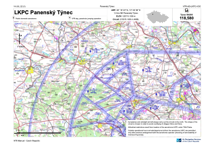
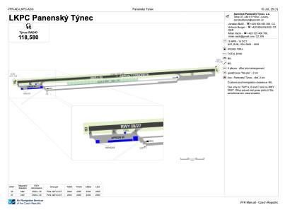


LKPC - Panensky Tynec
Located in Panensky Tynec, Czech Republic
ICAO - LKPC, IATA -
Data provided by AirmateGeneral information
Coordinates: N50°18'23" E13°56'6"
Elevation is 1207 feet MSL.
View others Airports in Ústí nad Labem Region
Operational data
Special qualification required
Current time UTC:
Current local time:
Communications frequencies: [VIEW]
Runways:
| RWY identifier | QFU | Length (ft) | Width (ft) | Surface | LDA (ft) |
| 09 | 86° | 8219 | 98 | ASP | |
| 27 | 266° | 8219 | 98 | ASP |
Airport contact information
Address: Panensky Tynec Czech Republic
