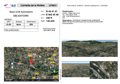


LF6631 - Corneilla de la Rivière
Located in Corneilla-de-la-Rivière, France
ICAO - , IATA -
Data provided by AirmateGeneral information
Coordinates: N42°41'27" E2°43'49"
Elevation is 230 feet MSL.
View others Airports in Languedoc-Roussillon
Operational data
Special qualification required
Current time UTC:
Current local time:
Communications frequencies: [VIEW]
Runways:
| RWY identifier | QFU | Length (ft) | Width (ft) | Surface | LDA (ft) |
| 12 | 0° | 820 | 0 | DIRT | |
| 30 | 0° | 820 | 0 | DIRT |
Airport contact information
Address: Corneilla-de-la-Rivière France